Profile : Shinobooth
【石川県・北陸の風景/ドローン空撮/4Kアーカイブ】
石川県・能登エリアを拠点に活動する映像クリエイターです。
日本海の美しい自然、海岸線、漁港の風景を中心に、ドローンによる高画質(4K)空撮素材を提供しています。
【主な提供素材】
■ 能登半島(震災前から)の海岸線アーカイブ
2024年の能登半島地震以前(〜2023年)に撮影された、海岸線・漁港・観光地の貴重な記録映像を多数保有しています。海底隆起や崩落前の「在りし日の美しい能登」の姿を、報道・ドキュメンタリー制作等にご活用ください。
■ ボートからの洋上視点
プレジャーボートを所有しており、陸からは撮影できない「海側からの視点」「沖合の映像」を得意としています。
■ ライフスタイル・DIY
釣り、バンライフ、DIYなど、アウトドア・趣味に関するシネマティックな実写素材も制作しています。
【技術仕様】
・4K撮影 / ドローン空撮対応
・カラーグレーディング済みのシネマティックな映像から、編集しやすいナチュラルな素材まで幅広く用意しています。
美しい北陸の風景を、映像作品の一部としてお役立ていただければ幸いです。
Speciality
自然・風景, 石川県, 能登半島, ドローン空撮, 海, 日本海, 4K動画, 震災前アーカイブ, 漁港, 絶景, アウトドア, 釣り, ボート, 空撮
Clients
・テレビ番組(ニュース、ドキュメンタリー、復興特集)
・自治体・官公庁の記録資料、防災教材
・観光PR、Webサイトのメインビジュアル(ヒーローイメージ)
・YouTube動画のインサート、BGM動画の背景
Hobby
■ ライフスタイル・DIY
釣り、バンライフ、DIYなど、アウトドア・趣味に関するシネマティックな実写素材も制作しています。
Camera Equipments
sony a7m4
sony a7s3
dji mavic pro
dji Inspier
Insta360
Graphic Softwares
Photo shop
After effects
premiere
Davinci resolve
LRTimelapse 6
Links
- GREAT SPOT ch
- https://www.youtube.com/@GREAT-SPOTch
- https://www.instagram.com/dfb_ism/
- 金沢・能登で動画制作・空撮ならDFB
- http://dfb.jp/

![[4K aerial photography] Bird's-eye view from directly above. Scrolling video tracing Minazuki Coast before uplift. For comparing topographical changes (pre-earthquake archives) [4K aerial photography] Bird's-eye view from directly above. Scrolling video tracing Minazuki Coast before uplift. For comparing topographical changes (pre-earthquake archives) 136146474](https://tf10.pimg.jp/136/146/474/0/136146474.jpg)
![[4K aerial shot] The rocky shore of Fukami, Monzen-cho, Wajima City. The view before uplift, seen from the foreground to the middle distance (photographed in 2023, Noto Archive) [4K aerial shot] The rocky shore of Fukami, Monzen-cho, Wajima City. The view before uplift, seen from the foreground to the middle distance (photographed in 2023, Noto Archive) 136064271](https://tf10.pimg.jp/136/064/271/0/136064271.jpg)
![[4K aerial photography] The rocky shore of Fukami, Monzen-cho, Wajima City. A low-altitude shot of the rock face before the uplift (photographed in 2023, Noto Archive) [4K aerial photography] The rocky shore of Fukami, Monzen-cho, Wajima City. A low-altitude shot of the rock face before the uplift (photographed in 2023, Noto Archive) 136064270](https://tf10.pimg.jp/136/064/270/0/136064270.jpg)
![[4K Aerial Shooting] Circling the rocky shores of Fukami and Mizujiri in Monzencho, Wajima City. A valuable record of the area before uplift (Noto Archive 2023) [4K Aerial Shooting] Circling the rocky shores of Fukami and Mizujiri in Monzencho, Wajima City. A valuable record of the area before uplift (Noto Archive 2023) 136064269](https://tf10.pimg.jp/136/064/269/0/136064269.jpg)
![[4K Aerial Shoot] The coastline of Fukami and Mizujiri in Monzencho, Wajima City. Panoramic view before uplift and gentle tilt (Noto Archive 2023) [4K Aerial Shoot] The coastline of Fukami and Mizujiri in Monzencho, Wajima City. Panoramic view before uplift and gentle tilt (Noto Archive 2023) 136064268](https://tf10.pimg.jp/136/064/268/0/136064268.jpg)
![[4K aerial photography] The rocky shore of Yoshiura, Monzen-cho, Wajima City. The rocky surface and waves before the uplift approach from low altitude (photographed in 2023, Noto Archive) [4K aerial photography] The rocky shore of Yoshiura, Monzen-cho, Wajima City. The rocky surface and waves before the uplift approach from low altitude (photographed in 2023, Noto Archive) 136064024](https://tf10.pimg.jp/136/064/024/0/136064024.jpg)
![[4K aerial photography] The rocky shore of Yoshiura, Monzen-cho, Wajima City. A forward tilt shot of the rocky area before it rose (photographed in 2023, Noto Archive) [4K aerial photography] The rocky shore of Yoshiura, Monzen-cho, Wajima City. A forward tilt shot of the rocky area before it rose (photographed in 2023, Noto Archive) 136064023](https://tf10.pimg.jp/136/064/023/0/136064023.jpg)
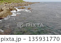
![[4K aerial photography] Yoshiura, Monzen-cho, Wajima City. A panoramic view of the rocky shore before the seafloor uplift. A valuable pre-earthquake archive (photographed in 2023, Noto) [4K aerial photography] Yoshiura, Monzen-cho, Wajima City. A panoramic view of the rocky shore before the seafloor uplift. A valuable pre-earthquake archive (photographed in 2023, Noto) 136064022](https://tf10.pimg.jp/136/064/022/0/136064022.jpg)
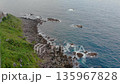
![[4K aerial photography] Near Yoshiura, Monzen-cho, Wajima City. A close-up of the rocky shore before the seafloor uplift. Valuable archive footage from before the earthquake (taken in 2023) [4K aerial photography] Near Yoshiura, Monzen-cho, Wajima City. A close-up of the rocky shore before the seafloor uplift. Valuable archive footage from before the earthquake (taken in 2023) 135967831](https://tf10.pimg.jp/135/967/831/0/135967831.jpg)
![[4K aerial photography] Near Yoshiura, Monzen-cho, Wajima City. A bird's-eye view of the rocky shore before the seafloor uplift (photographed in 2023, Noto Peninsula pre-earthquake archive) [4K aerial photography] Near Yoshiura, Monzen-cho, Wajima City. A bird's-eye view of the rocky shore before the seafloor uplift (photographed in 2023, Noto Peninsula pre-earthquake archive) 135967830](https://tf10.pimg.jp/135/967/830/0/135967830.jpg)
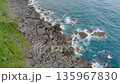
![[4K aerial photography] The coastline and reefs near Yoshiura, Monzen-cho, Wajima City before the uplift caused by the earthquake (photographed in 2023, Noto Peninsula Archive) [4K aerial photography] The coastline and reefs near Yoshiura, Monzen-cho, Wajima City before the uplift caused by the earthquake (photographed in 2023, Noto Peninsula Archive) 135967829](https://tf10.pimg.jp/135/967/829/0/135967829.jpg)
![[4K aerial footage] The coastline of Yoshiura, Monzen-cho, Wajima City. Valuable documentary footage from before the seafloor uplift (filmed in 2023, Noto Peninsula) [4K aerial footage] The coastline of Yoshiura, Monzen-cho, Wajima City. Valuable documentary footage from before the seafloor uplift (filmed in 2023, Noto Peninsula) 135967828](https://tf10.pimg.jp/135/967/828/0/135967828.jpg)
![[4K Aerial Shooting] Isoshima, Noto. Low altitude approach over the rocky area before the 4m uplift. Archive of pre-disaster records (photographed in 2023) [4K Aerial Shooting] Isoshima, Noto. Low altitude approach over the rocky area before the 4m uplift. Archive of pre-disaster records (photographed in 2023) 135931770](https://tf10.pimg.jp/135/931/770/0/135931770.jpg)
![[4K Aerial Shoot] Noto, Isoshima. Moving straight ahead along the coastline before the 4m uplift. Archive of pre-earthquake records (taken in 2023) [4K Aerial Shoot] Noto, Isoshima. Moving straight ahead along the coastline before the 4m uplift. Archive of pre-earthquake records (taken in 2023) 135931769](https://tf10.pimg.jp/135/931/769/0/135931769.jpg)
![[4K Aerial Shooting] Isoshima, Noto. The rough sea before the 4m uplift. A three-dimensional record of the nose-in circle (photographed in 2023) [4K Aerial Shooting] Isoshima, Noto. The rough sea before the 4m uplift. A three-dimensional record of the nose-in circle (photographed in 2023) 135931768](https://tf10.pimg.jp/135/931/768/0/135931768.jpg)